At a Glance
- Florence will slowly move farther inland in the Carolinas on Saturday.
- This will produce catastrophic flash flooding and major river flooding.
- Life-threatening storm surge has already occurred in eastern North Carolina.
- Flash flood emergencies have been issued for eastern North Carolina.
- Florence’s remnant will linger in parts of the East into early next week.
Florence will slowly move westward this weekend bringing heavy rainfall and strong winds to the Carolinas, producing catastrophic inland flooding before kicking off an agonizing crawl through the Southeast and Appalachia into early next week,
Happening Now
Rainfall amounts have totaled 15 to 25 inches in many locations in eastern North Carolina through early Saturday. Local roadways are impassable and are closed in numerous locations, which has isolated residents.
As a result, several flash flood emergencies remain in effect Saturday morning in eastern North Carolina due to these conditions and additional rainfall:
- Southeastern Jones, southeastern Craven, Carteret and Pamlico counties, including New Bern, Morehead City, Newport
- Jones, southwestern Lenoir, northeastern Onslow and northeastern Duplin counties, including Jacksonville, Kinston and Swansboro
- Southwestern Onslow and Duplin counties, including North Topsail Beach and Mount Olive

(Watches and warnings are issued by the National Weather Service.)
Florence is located about 35 miles west of Myrtle Beach, North Carolina or 45 miles south-southeast of Florence, North Carolina, as of early Saturday morning.
It will continue to move slowly this weekend and a turn toward the west and northwest is anticipated later Saturday and Sunday.
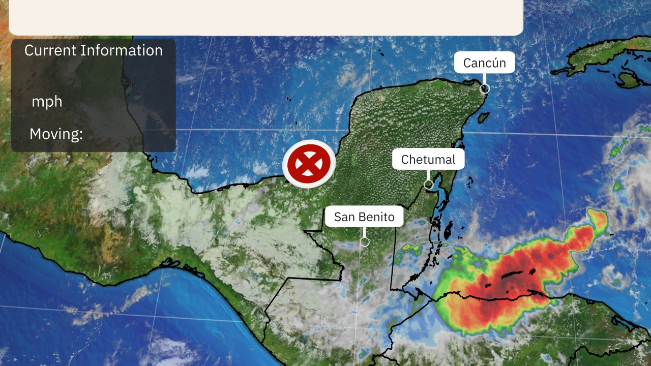
(The highest cloud tops, corresponding to the most vigorous convection, are shown in the brightest red colors. Clustering, deep convection around the center is a sign of a healthy tropical cyclone.)
Two spots are aiming to take down North Carolina’s tropical cyclone rainfall record: Newport with 23.75 inches of rainfall and Morehead City with just over 23 inches so far. The previous record is 24.06 inches from Hurricane Floyd in 1999.
As of Saturday morning, winds continue to gust higher than 50 mph at times. A sustained wind of 48 mph with a gust to 57 mph was recently reported at Mercer Pier, North Carolina.
For additional rain, wind and storm surge reports, see the bottom of this article.

Tropical storm warnings remain posted near and inland from the coasts of North Carolina and South Carolina.

(A watch means hurricane or tropical storm conditions are possible within 48 hours. A warning means those conditions are expected within 36 hours.)
Steering currents have fallen apart allowing Florence to slow down tremendously as it drifts in eastern South Carolina.
Gradual weakening of winds is expected over the weekend as it moves farther inland, but extremely heavy rainfall will increase flooding potential.
Florence will move through the southern and central Appalachians this weekend into early next week.

(The red-shaded area denotes the potential path of the center of the tropical cyclone. It’s important to note that impacts (particularly heavy rain, high surf, coastal flooding, winds) with any tropical cyclone usually spread beyond its forecast path.)
By early to mid next week, whatever is left of Florence will swing northeastward across the northern Appalachians and into the Northeast.
(Florence’s Final Chapter: The Northeast Forecast)
Forecast Impacts
– High-Impact Rainfall: Florence will produce high-end flash flooding between Myrtle Beach, South Carolina, and Morehead City, North Carolina.
The National Hurricane Center noted that “life-threatening, catastrophic flash flooding and prolonged significant river flooding are likely over portions of the Carolinas and the southern and central Appalachians late this week into early next week.”
That heavy rain threat may last for days into early next week in some areas, given Florence’s slow movement. Returning evacuees should be aware that flooding may last in the eastern Carolinas well into next week, including flooding across roadways and into homes.
Disastrous flooding is expected in some areas, not simply near the coastal Carolinas where the heaviest rain totals are forecast, but also in the Appalachians where heavy rain over mountainous terrain is likely to trigger mudslides and rockslides. See the link below for more information.
(MORE: Potentially Catastrophic Inland Flooding Possible)
According to the National Hurricane Center, Florence is expected to produce the following rainfall totals:
- Southern and central portions of North Carolina into far northeastern South Carolina: an additional 10 to 15 inches, with isolated totals up to 40 inches
- Rest of South Carolina and North Carolina into southwestern Virginia: 5 to 10 inches, with isolated totals up to 15 inches
- West-central Virginia into far eastern West Virginia: 3 to 6 inches, with isolated totals of 8 inches.
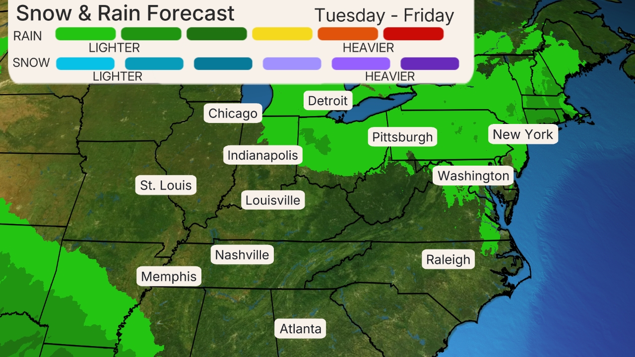
(This should be interpreted as a broad outlook of where the heaviest rain may fall and may shift based on the forecast path. Extreme amounts may occur where bands of rain stall over a period of several hours. )
The runoff from these incredible rainfall totals will continue for days, and then will enter the riverways of the Carolinas. Flooding may swell these watersheds for weeks, if not months.
– Storm-Surge Impact: A destructive storm surge accompanied the eye coming ashore Friday, and coastal flooding may persist through multiple high-tide cycles into this weekend. The next high tide for Wilmington and Hatteras will be early this afternoon.
Significant beach erosion is also likely on the southeastern U.S. coast. Elevated water levels may persist for some time after landfall in areas where onshore winds persist.
(MAPS: NHC Potential Peak Storm Surge Inundation Interactive Maps)
Here are the latest storm-surge inundation forecasts from the National Hurricane Center at high tide:
– Along the Neuse, Pamlico, Pungo and Bay rivers: 3 to 5 feet
– Ocracoke Inlet to Cape Lookout, North Carolina: 2 to 4 feet
– Cape Fear to Cape Lookout, North Carolina: 3 to 5 feet
– Myrtle Beach, South Carolina to Cape Fear, North Carolina: 2 to 4 feet

(From the National Hurricane Center.)
These water levels will be on top of already high tides caused by the new moon.
Battering waves will ride atop the storm surge, inflicting more damage to structures near the water as the hurricane arrives.
– Wind Impact: Tropical-storm-force winds (39-plus mph) are expected to continue across much of eastern North Carolina and northeastern South Carolina through Saturday.
Numerous downed trees and long-lasting power outages are expected.

– Tornadoes: A few tornadoes are possible in eastern and southeastern North Carolina on Saturday. These tornadoes should be weak and short-lived but could add to damage caused by rainfall or straight-line hurricane winds.
NOAA’s Storm Prediction Center has issued a tornado watch for portions of southern North Carolina through 7 a.m. EDT.
Florence’s Storm Reports
Florence made landfall near Wrightsville, North Carolina, at 7:15 a.m. EDT with maximum sustained winds around 90 mph.
Wind Reports
Wind gusts reached as high as 106 mph at Cape Lookout, North Carolina, late Thursday evening while a 105-mph gust was reported at Fort Macon, North Carolina.
Friday morning, Wilmington, North Carolina, recorded a wind gust to 105 mph, the second strongest wind on record here. A wind gust to 100 mph was reported at Cape Fear, North Carolina earlier Friday and a buoy about 50 miles to the east of the center of Florence’s eye reported a wind gust to 112 mph.

Winds were gusting as high as 99 mph at Fort Macon, North Carolina and sustained winds are blowing at 73 mph early Friday.
Sustained winds of 79 mph were reported in Davis, North Carolina, while a 77-mph sustained wind was recorded at Fort Macon, North Carolina.
A gust of 72 mph was reported at Wrightsville Beach, North Carolina Friday evening.
Water Reports
Newport, North Carolina, has reported 23.75 inches of rainfall, while Morehead City, North Carolina, has recorded 23.04 inches as of early Saturday. Numerous locations have received more than a foot of rainfall so far and the rain continues to fall.

Overwash of the dunes at the “S” curves on Highway 12 near Rodanthe in the Outer Banks began on Thursday.
On Thursday night, a storm surge of 10 feet above normal levels was reported by the National Weather Service office in Morehead City, North Carolina, at the Cherry Branch Ferry Terminal on the Neuse River, courtesy of the North Carolina Department of Transportation.
A gauge at Oriental, North Carolina, on the Neuse River recorded a water height of about 6 feet above normal tide levels late Thursday.
(MORE: North Carolina Meteorologists Forced Off-Air During Broadcast By Florence Flooding)
A record tide level was set at Beaufort, North Carolina, very early Friday, topping levels seen during Hazel (1954) and Floyd (1999), among others, with a reading of 7.28 feet.
(MORE: Florence Breaks Surge Records in Two Cities)
Water levels remain elevated in Pamlico Sound in North Carolina Friday evening and a gauge in Emerald Isle recorded a 7.0-foot surge Friday morning. A 10.1-foot storm surge was recorded very early Friday in New Bern.
Florence helped push water up against the coast as far north as the Chesapeake Bay Friday evening. Minor flooding has been reported in Maryland, which reported water levels 2.7 feet above normal.
Florence’s History
Tropical Depression Six formed late on Aug. 31, then was named Tropical Storm Florence the next day in the far eastern Atlantic Ocean.
On Sept. 5, Florence became a Category 4 hurricane after rapidly intensifying over the open Atlantic Ocean.
Wind shear then weakened Florence back to a tropical storm late on Sept. 6.
Florence underwent rapid intensification a second time Sunday into Monday, when its winds jumped up from 75 mph to 130 mph in just 25 hours ending 12 p.m. EDT Monday.
[Disclaimer]

